
Days 176 - 184: The Slackpack Saga
Day 176: Mile 1817.8 | Home
We chose to slackpack the peaks of Kinsman. In the beginning, we were thinking we might not slackpack the rest of the whites because of how big (in mileage) the days would have to be to accomplish the other sections of these formidable mountains. This section was a little over 16 miles. The way up was great, the ridge between the peaks was beautiful, the weather was great, but the way down was strenuous. It was steep, wet and slippery. There was mud everywhere. I even fell in a huge mud puddle on the first peak.


On our way down the second peak, we could see a thunderstorm rolling in. The descent was steep, slippery and sketchy. At one point the trail literally was a waterfall.Much like Moosilauke, the way up was surprisingly easier than the way down. It took nearly twice as long as we had planned. We had estimated we would be at the trailhead by 7:30 or 8pm, but we were only a quarter of the way down the second peak by the time 8pm rolled around and darkness was imminent.


The descent intimidated Miles. On top of that, we were both hungry and tired. We slowly made our way down with me leading the way. By the time we got to Lonesome Lake Hut, the storm was audible but not visible. It wasn’t close enough to really affect us, as far as we could tell from the thunderclaps.


For a moment, we stood by the lake and took in its beauty. Until we realized how late it was getting! We scurried down the path toward our pickup location. Over rocks and floating swamp boards, we descended toward Franconia Notch.
We had planned to get picked up at a trailhead at the end of the day off of I-93 around Franconia Notch. In the dark, though, it was hard to see. Crossing the last stream with just our headlamps proved difficult because we couldn’t see the rocks beneath our feet under the silvery reflective water. We also couldn’t see the blazes on the other side of the stream. After that last stream, the trail leads us under I-93 along the side of the stream we had just crossed. The trailhead we were to be picked up was supposed to be off of a blue blaze right after the road crossing. Looking at the map on my phone in the dark, I couldn’t tell how long the blue blaze was or where it even started. Turns out, we were a quarter mile short of the blue blaze when we began to panic.
I called my mom, who was to be picking us up. We couldn’t find the blue blaze, I told her. Is it possible that she can just pick us up on the side of the road? I found our coordinates through Guthook because I couldn’t get enough service to use Google Maps. She manually inputted our location into her phone after a five-minute panic session of trying to find it. I couldn’t even tell from where I stood if we were on the Northbound or Southbound side of the highway. I could only read one sign, the name of the river we were standing next to. A river that this highway crossed twice and on both sides of the road.
Eventually, she found us as we flashed our headlamps on the side of the road. We quickly got into her car on the side of the highway and she drove us toward home. Not five minutes after we got into the car rain started falling. By the time we got to Route 302, the road home, it started to downpour so hard we could barely see ten feet in front of us. An hour and a half later, we made it home.
Day 177: Mile 1817.8 | Home
On this day we took a much needed zero. We went and got more snacks at Walmart for the rest of the week. I found my new favorite granola bar: the Nature Valley XL Bar. We also got Miles a new headlamp at the local outfitter after discovering how difficult night hiking with the one he had was. 100 lumens just wasn’t enough to reliably night hike a good distance, especially if it rained or we were on technical terrain. After this, we rested.
Miles kept bringing up our slack pack plans for the next day. We had decided to do about 22 miles over Franconia ridge the next day. Mt. Lafayette was one of my favorite mountains to hike and I was excited to show it to Miles. But I’d hiked it before and it was hard. Sure we’d be taking some different trails than the ones I had taken last time, but it would still be hard. I was nervous and the more he brought it up the less I wanted to do it. I didn’t believe that I was really ready. But, like every other part of the AT, I just tried not to think about it. Stop thinking and just DO. Had become my motto on this journey and it applied this especially.
Day 178: Mile 1838.0 | Home
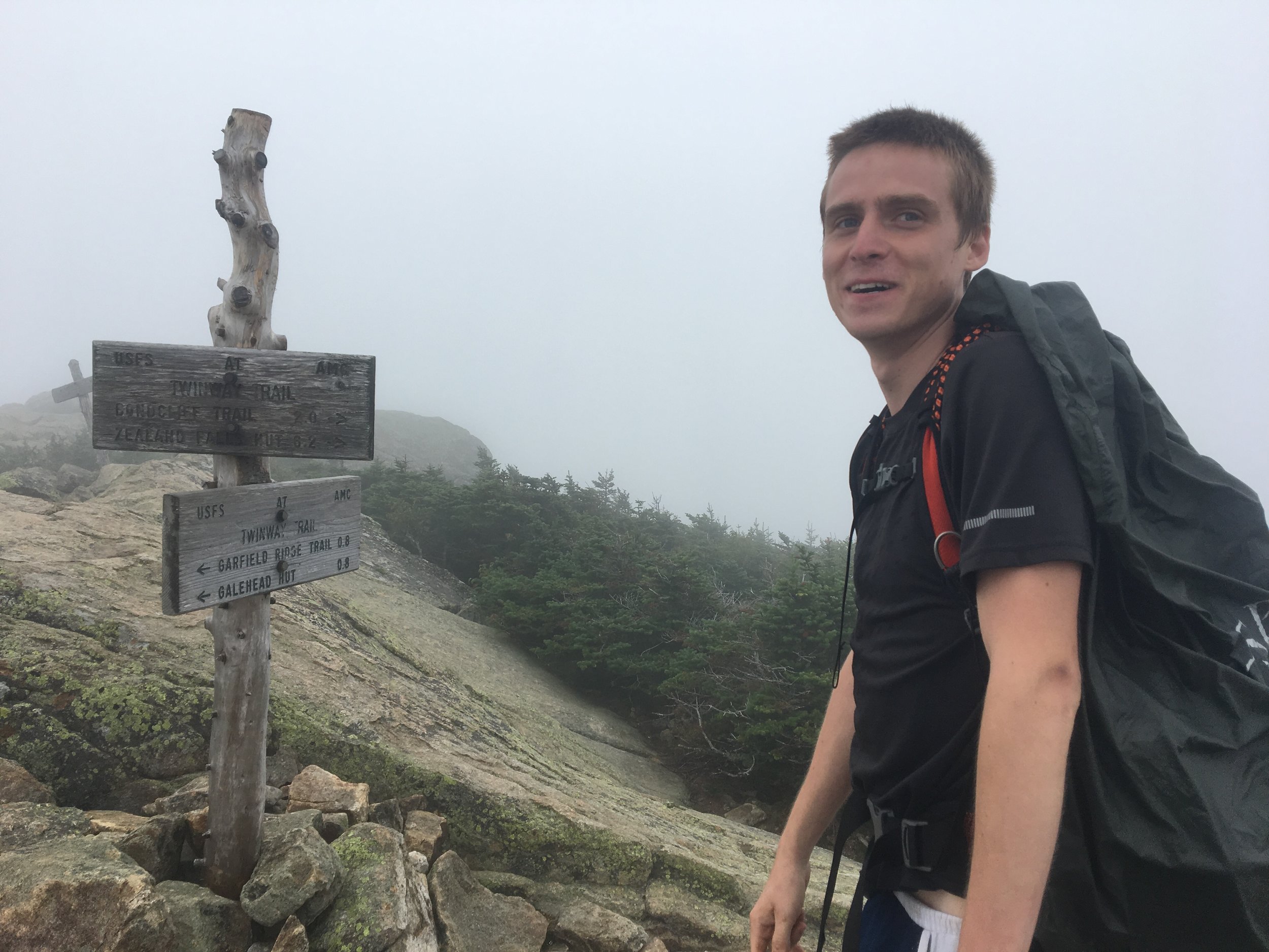
On this day we went from Franconia Notch, I-93 where we left off, to the Zealand Falls Trail. We took the blue blaze at Zealand Falls to the trailhead where our parents would pick us up, adding 2 extra miles to the already 20-mile day but avoiding a 29-mile day. We got up early and stopped at McDonald's for a quick breakfast on the way. We were on the trail by 7:30am. I was really intimidated by the high mileage day, especially over these peaks. I sacrificed sacred natural quiet and listened to some motivational music. It helped distract me from the pain of climbing and my fears enough to make it through with confidence.


We quickly passed Liberty Spring Tent Site and steadily climbed up toward Lincoln. Every time I turned around a beautiful view was waiting for me and the accompaniment of motivational music only made it that much more amazing. Once we got to the Alpine Zone I took my headphones out. Miles and I had a rule: No music, podcasts, or media of any kind, in the Alpine Zone. It’s a sacred space that you work hard to get to so you should savor it. We followed the ridge up Lincoln and past the junction of the Falling Waters Trail, the trail I usually took to get to the top of Lafayette. We slowly made our way over the ridge, taking in the views.


It’s amazing how much perspective I’d gained on the trail. Four years ago, the last time I had hiked Franconia Ridge, I felt like I was so high up. The boulders on top of the ridge had seemed so huge and the drops down the side of the mountain had seemed so long and dangerous. Now, after estimating the distance between visible peaks for a few months, I knew how far away things were. I knew that the hut I could see, Greenleaf, was only a mile away just from looking at it. I knew that Mt. Garfield was just two or three miles ahead even though it looked so far away and so big. I was no longer scared of this mountain, a mountain that had once seemed to me like walking in outer space. Now it felt like home. Just another place I liked to be. I had dreamed for months about getting to this point on trail. To the point where I would walk the mountains that I knew, that I'd been to before. In the distance, we saw more dark clouds, but Mother Nature held out for us over the ridge. It was misty and foggy at times after that but still so beautiful and it didn’t rain.

IMG_9287

IMG_9288
The two of us stopped on the summit of Lafayette and I ate the leftover Chinese Food that I brought from the night before. The cold noodles were surprisingly satisfying to my raging stomach. I couldn’t eat enough. I took my jacket off after I finished eating and we continued on.
By the time we'd gotten to the true summit of Lafayette my fears and nerves had subsided. I had made it this far, I could most certainly make it all the way. Perhaps it was the endorphins or adrenaline or maybe all the sugar and caffeine I'd had that day, but I felt really good. I had loads of energy once I got moving. Being in this place felt comfortable but also somehow dangerous.
We made it across the ridge and past the trail junction that leads down to Galehead Hut, where I’d filled up on water and eaten potato and leek soup four years ago. I remember how surprised my friends were when I had shown up in trail runners to hike that 10-mile loop with them. Now, I looked down at my La Sportiva trail runners, multiple pairs of which had carried me all the way here from Georgia, and laughed. How naive and inexperienced I had been. Practice makes perfect.


We’d climbed, crossed and began descending Franconia ridge in nearly half the time it took me on that hike four years ago. We climbed Garfield and made our way to Galehead Hut. We refilled our water bottles there and ate a snack. Outside we saw the most beautiful fog rolling by in the ravine nearby. After that, we made our way through the fog to Zealand. As the sun began to set we passed the Zealand Hut and Falls and quickly walked down the easy path toward the trailhead.


Headlamps on, we scurried down the path: first speed walking, then jogging, then flat out running. Not from fear of the dark or missing our ride (we were actually on time!), but because we had the energy. I felt SO STRONG. I felt like NOTHING COULD STOP ME. I could not believe that after 22 miles I had this much energy. I was elated. My heart and my mind were full. I had almost no fear anymore. I strongly considered getting into ultra running the entire day. I finally felt capable, confident, and happy.


Mom and Dad picked us up at the trailhead at 9pm. They brought us oranges to eat and Gatorade to drink.
It was on this day that I decided to write a book for sure and on my book title.
Day 179: Mile 1838.0 | Home
This was another zero-day. It rained hard. I spent the day sleeping, eating, and recovering.
Day 180: Mile 1845.0 | Home
We made a crazy decision on this day. We planned our last two slackpacks. 9 miles today to finish up what we cut off by taking the Zealand Falls trail. 27 miles the day after next to complete the Whites (keep reading, friends). The short 9 miles were the easiest section of the Whites by far. Mom and Dad hiked the Zealand Falls trail while we did our section. We jogged and walked past Ethan Pond and down to Crawford Notch. Mom and Dad picked us up there.


While we were waiting for Mom and Dad to arrive we found Butter (the Hiker not the condiment)! We’d met only once before in passing in New York when we’d camped next to each other. She told us she had hitched a ride into Bartlett to go to the country store there and she accidentally left her new poles in the car of the person who gave her a ride. She never got his contact info. I felt bad, her Z-Packs tent could only really be pitched well with trekking poles. She’d been carrying two sticks that happened to be almost the right length but she missed her poles.
When I got new poles in Connecticut after my REI poles had broken and I broke the poles that Davey had sent me, I kept my old REI poles just in case. My parents took them home with them from Pawling New York. They weren’t in great shape, the locks slipped often, but if you didn’t mind tightening them every day, they still kind of worked. I offered them to Butter and I also told her we could take her to the outfitter in North Conway instead if she wanted a new pair. She agreed to take my REI poles and we took her home with us.
She showered and my mom washed her laundry. I gave her my poles and some extra duct tape in case she needed to tape them together if one of the locks finally broke. We all piled back into the car and dropped Butter off at the trailhead. There she rains into her friends Poppins and Peanut, two hikers I’d meet later in New Hampshire. After we left Butter, Mom and Dad took us out to dinner at the Cider Company down the street. One of the best dinners I’ve EVER had. We had lively conversation over cider and good food. Mom and Dad convinced us to go through with the marathon after one more zero. Their confidence in us might be what really convinced me to go through with it.
We drove home after dinner. Miles and I sat in the van that night and planned our marathon. Even after the 22-mile day, at the end of which I felt like I could keep going at least 8 more miles, I felt nervous. I didn’t think that I could do it. Don’t think about it just do it, don’t think about it just do it, don’t think about it just do it, don’t think about it just do it, I said over and over in my head. We made a plan to sleep in the van at the Crawford Notch trailhead the night before, get up at 2am, and get picked up at the Pinkham Notch Visitor’s Center at 9pm that night.
Day 181: Mile 1845.0 | Home
We took one more zero and Miles felt like he had a stomach ache all day. We packed up the van that night and were ready to sleep at the trailhead that night to get up early and hike. On our way to the trailhead, we stopped to get gas and Abby, the van, started smoking out of her engine bay and the smell of coolant filled the car. A bad omen, we decided we couldn’t risk bringing her an hour away up into Crawford Notch where there was no cell service even if we could fix her tonight. My parents came out and picked us up. AAA towed her to Fryeburg Motors. We found the source of the problem, a split hose to the radiator.

IMG_9422
In lieu of the van, Mom and Dad let us take their station wagon up to the trailhead. We folded down the rear seats and put our sleeping pads and sleeping bags on top of them. I drove us to put to the trailhead and by 10:30pm we were parked and getting ready to go to bed. We got all cozied up in our blankets in the chilly evening air. I heard a noise after a moment that sounded like it was coming from the car. I rolled over and looked for it. The noise happened again. I made sure the car was in park and the parking brake was on.

I laid back down and the noise happened again. After a while, we realized the noise was coming from the car’s level sensors. It levels itself every time something shifts inside. Eeee oooo. Eeee ooo. We heard every time we rolled over. I fell asleep eventually anyway. I had forgotten how well I could sleep on this sleeping pad after a week in a real bed.
Day 182: Mile 1872.0 | Home
The alarm went off at 2am. I snoozed it. I was so tired. It went off again at 2:30am and we had to get up. We packed our day packs with snacks and water, got dressed, and laced up our shoes as we got out of the car. I locked it, my parents would pick it up later with the spare key, and left a parking payment envelope on the dashboard.

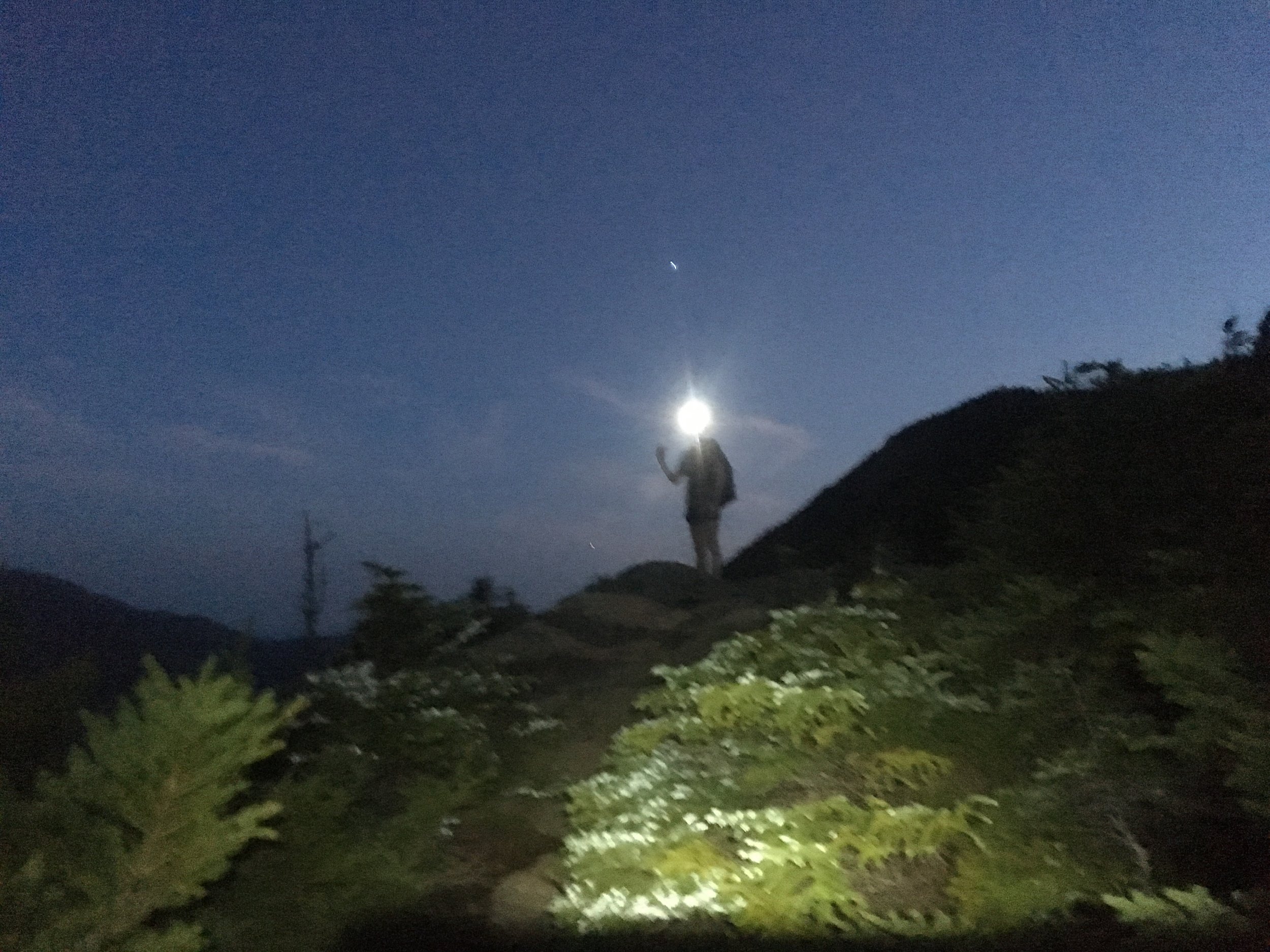
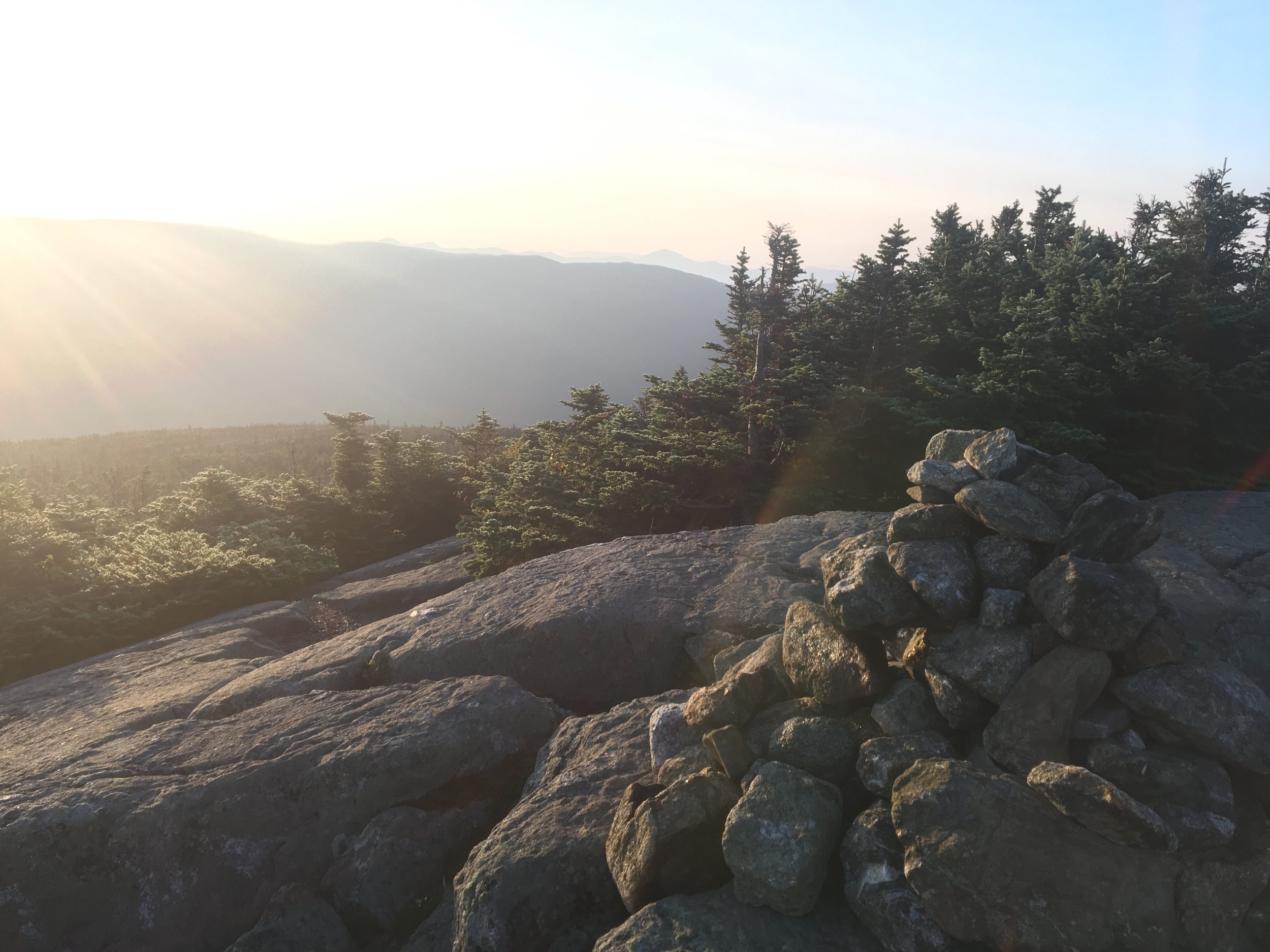
We crossed the street from the parking lot and headed up the AT by 3am in the dark. Our headlamps lighting the way, we slowly climbed up to Webster Cliffs. The sunrise view was STUNNING. A foggy mist filled the air with the forecasted storm’s moisture. The air was chilly but it felt good, long sleeve shirt and shorts kind of weather.


After a brief pause on Mt. Webster to take in the views we kept pushing uphill toward Mt. Jackson, from which we could see all the way to Mt. Washington. At Mizpah Spring Hut, shortly after the peak of Jackson, we stopped for our ‘breakfast’ of bananas, ProBars, and half a package of gummies. I mixed myself a caffeinated pre-workout drink and stowed it in my backpack for later. We filled up our bottles, used the bathroom at the hut, and continued uphill.


We followed the trail around the peaks of Eisenhauer and Monroe all the way to Lake of the Clouds Hut. After Mizpah Hut we maintained altitude in the Alpine Zone. The sun was shining and the clouds were scarce aside from some fog drifts.


At Lake of the Clouds, we snacked, refilled our water, and took a short break again. I signed the log book there, commemorating our Marathon. We finished our break and packed our food bags up. The sun was shining and the wind was tamer than I’d ever experienced before on Mt. Washington. Miles and I followed the day hikers around us up to the top of Mt. Washington, the last stretch of a 14-mile climb. We followed the cairns over the boulders and through the alpine zone.


At the top, we were met by a crowded, rocky summit. The observatory was busy and the parking lot for the Mt. Washington Auto Road was packed. Tourists stood in like 20 people deep to get their photo taken with the sign. There were no thru-hikers in sight. It felt strange to even call ourselves thru-hikers since we had been slack packing so much lately. We stood in line and got our picture taken. After the photo, we sat on the observation deck and absorbed the sun. There was no wind on the summit this day and it was nearly 70 degrees out. I had never experienced that sort of weather on the summit before.


Another snack was required at this point and I stuffed gummies, peanut butter crackers, and an XL bar in my mouth ravenously. The tourists stared at us as the walked to the edge of the observation deck. As we sat there, taking in the people, we realized how much this space felt like purgatory. We couldn’t see much of a view from where we sat: only clouds around the edge of the deck and clear, blue skies above. Tourists walked around in hiking clothes, street clothes, fancy street clothes, camouflage hunting clothes, or shorts and flip-flops. The mix of people, clothing, and views was so varied and strange.
We stayed up there for a bit, just absorbing the whole thing and letting our bodies rest. At this point, my glutes, thighs, and calves were starting to get sore from climbing. But I knew that it was almost completely downhill from here. Anywhere else I would have been thrilled by that notion, but in the Whites, it seemed almost as if the downhills were worse than the uphills. I sent my mom a quick update on our estimated finishing time while I still had service.
I was content here. Proud of myself for actually getting up early and pushing myself. I felt so accomplished to even make it this far. I’d almost literally walked home and that felt pretty damn good. I wasn't elated or on top of the world as I'd felt on Franconia Ridge. But crossing the ridge that day is what set me up to do this marathon. Knowing that I could make it through 22 miles in the Whites and still feel good at the end was proof enough to myself that I could pull of a marathon.
Miles and I made our way back to the trail to begin the 13-mile descent into Pinkham Notch.


As we meandered down the side of the mountain we came to the crossing of the Cog Railway. A teenaged boy sat on the tracks as an engine began leaving the station above him at the peak of the mountain. While the engine whistled its horn and came barreling down the mountain the boy did not move. I, afraid, said to him, “You might want to move!” He looked at me and laughed as if my fear of the train was preposterous.
I soon realized, the train moved so slowly he had plenty of time to move. I even had enough time to cross the train tracks before it arrived. But my fear of large moving vehicles had grown during my time on the trail. I spent less time in cars and on trains and around these powerful, heavy, fast-moving machines. I wasn’t desensitized to the sheer force these vehicles could produce, their deadlines. Ever since I’d been home I drove slower and more carefully than ever. I refrained from speeding and I did n’t care if I went slowly as long as I got there safely. I was more sensitive to my car’s power. A feeling I’d never really noticed before.
We continued on after the railway, down the rocky path and around the peaks of Mt. Clay, Mt. Jefferson, and Mt. Adams. Once we got to Adams I began to feel the fatigue hit me. I drank my pre-workout for the caffeine and pushed on. We followed the cairns all the way down and when we came to Mt. Adams I had to check to make sure we were following the right paths. Three trails, all marked with cairns of the same rocks and colors, diverged on this peak and the margin for error was big. Once we found the right path we continued on and the fog began to envelop us.

img_1429

img_9602

img_9597
My contacts had now been in my eyes for nearly 13 hours. They began to feel dry and itchy, my vision began to blur, and I hadn’t brought any contact solution to fix them. I hadn’t even brought my glasses. I squinted in the dim, moist fog and tried to best to spot the cairns and random blazes among the other rocks. My hair and skin became wet from the fog as we descended. Finally, after what felt like much longer than it should have been, we came upon the Madison Hut. I got a cup of tea from the hut and Miles boiled the water for our Mountain House Meals.


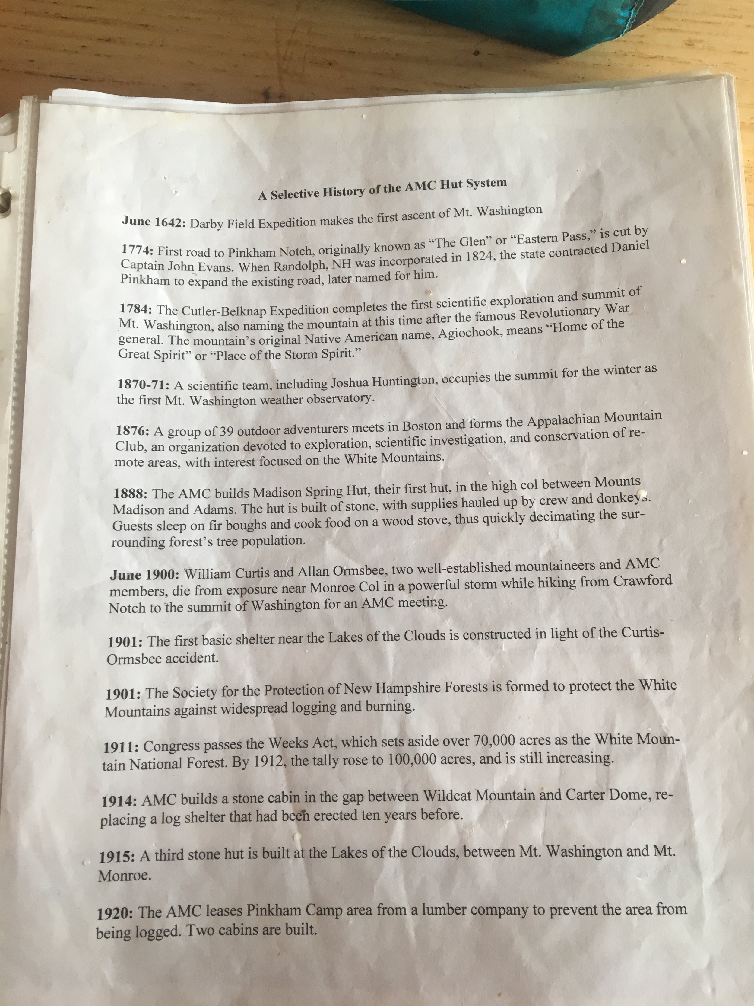
I was so hungry and tired by this point that I almost didn’t want to keep going. My legs weren’t as sore as I thought they would be by this point, though. My eyes were dry and itchy and my bottomless pit of a stomach could not be satiated. Together, we ate our rehydrated meals inside the hut while we read a book on the history of the AMC hut system.
Once we’d polished off our meals we packed our trash up and brought it with us. We donned our insulated jackets, raincoats, and headlamps now. The sun would be setting in two hours and we need to make it five more miles down to Pinkham Notch. We climbed the last little ascent up to the top of Mt. Madison after the hut, darting around the slower tourists. My legs were stiff, at first, from sitting during our meal but they quickly warmed back up. I pushed Miles and to go faster. The further we could get in daylight the easier it would be. I was exhausted, by this point, not from the physical exertion, but from the mental work. Finding the cairns in the fog with my dry contacts was proving to be difficult and taxing. Watching every step over the slippery chunks of granite beneath our feet proved to be another struggle all on its own.

IMG_1464

IMG_9620

IMG_9622

IMG_1472

IMG_9624

IMG_1476
But my happiness was unmistakable. Even as grumpy as I got at the end of the day I was still thrilled to be out there. As taxing as the mental game was I pushed through and kept telling myself, You get a bed at the end. You get a bed at the end. Just make it home. You can do it. By not bringing my whole pack I gave myself no choice but to finish. I’d never hiked a distance like this before, I’d never even walked or run a distance like this on flat ground! I reserved my energy as much as I could and took in the beauty and awe of almost an entire day in the Alpine Zone. I absorbed as much sunlight as I could and basked in the feeling of immense gratitude that washed over me as I thought about carrying 35 pounds on my back up these peaks and sleeping on the floor of a hut I didn’t belong in every night.
The descent of Madison’s peak was by far the longest and most strenuous part to me. It wasn’t that technical or difficult but the fog and quickly setting sun exaggerated the difficulty of this section. By the time we made it down to treeline, we were so glad to hunch down behind the small, bent pines to catch a break from the wind that was whipping us with its wet clouds. A quick bar, motivational regroup, and we were off again. I lead the way down the steep trail as fast as I could. The fog cleared as we descended and the trail, even though it was quite steep and technically challenging felt like a breeze compared to the tedious peak of Madison. My feet found the rocks and dirt footholds as I barreled down the mountain. After a bit, I broke a sweat and even had to take off my jacket.

IMG_1482

IMG_1487

IMG_9625
The sun set slowly and we made good time after we passed Osgood Tent Site. In the dark, we crossed the Auto Road again. It was eerie and deserted after dark. We pushed past it quickly and came to a flat carriage path that lead us the rest of the way to Pinkham Notch. Once we hit the gravel path toward the end with 1.2 miles left, I went all in. I took every last ounce of energy I’d been saving all day and jogged it in. Miles lead us over a stream, and down to the visitors center. We came out into the parking lot lights caught our breath. I could have kept going! I felt incredible.
Strong, capable, content, hungry, and exhausted. My mom picked us up and we drove homeward down Rt. 302. I knew in my mind that if I gave myself no choice but to finish (not carry any gear), then I could definitely do this again. I imagined ultra running during the entire ride home. I’d never felt this kind of happiness: content but elated, strong but exhausted, accomplished but still hungry for more.
Day 183: Mile 1872.0 | Home
A rainy zero day.
Day 184: Mile 1872.0 | Home
One last zero to recover from the impact on my knees.
Day 185: Mile 1893.6 | Home
The last slackpack day we finished the Presidential Mountain range and most of the Whites. On trail by 7am, we set out to do 21 miles over the Wildcat's peaks, Mt. Carter, and Mt. Moriah. The day was slow going and arduous. It wasn't that the terrain was really that challenging, not after the terrain we had already encountered, it was more of a mental struggle.

IMG_9881

IMG_9885

IMG_9886
The huge distance days really were never my favorite. I loved them in short spurts: a few 20-24-mile days here and there, perhaps a 16-mile day scattered amongst them. But when every day was more than 20 miles long it got tedious to me. The mental stamina necessary to travel that distance many days in a row was not my forte, although many others found it came naturally to them. I took a lot of breaks. I took in a lot of the beauty. I had little motivation to go far or fast. The burnout feeling was really setting in.
We stopped for lunch and a bathroom break at the Carter Notch Hut. We ate next to one of the alpine lakes up there and listened as a few other hikers floated on another lake nearby. The day was absolutely beautiful. No clouds. No rain. No fog. I loved the feeling of just being out there with the light breeze. It was at this point that I realized the end was truly nigh. I began trying to absorb the feeling of having almost no pressure, beautiful surroundings, and low stress. I savored the time I had with the trail and with myself in a way that I hadn't thought to before.

IMG_9896

IMG_9897
I would be leaving home after today and not returning until I summit Katahdin. That realization sunk in deep and I had a hard time fathoming that it would soon be over with 300+ miles ahead of us. Discovering Carter Notch was one of my favorite things that happened during the slackpack saga. Right in my valley, I promised myself I'd go back there in the winter. I found myself making lists of the places on the AT that I wanted to revisit. I never could have realized when I first set out on this journey how much the trail would turn out to feel like home, like my favorite place, how much I'd learn to love it.

IMG_9899

IMG_9901
As the sun was setting and we descended Mt. Moriah we sped up our pace and speed walked over the rooty floor of the pine forest. We passed the Rattle River shelter and rain into Hooch and Jukebox! We talked with them for a bit in the dark around their campfire before continuing on to the road. It was nice to be recognized, even with our daypacks on. It made me feel like I was still a thru-hiker, still a part of the community. Slackpacking all week had kind of made me feel a bit like a fraud. Like other hikers might not accept me as much because I'd slackpacked such a big and notoriously difficult section. Hooch told us no one would judge us, especially if we told them how many miles we'd managed to pull off each day during that section.
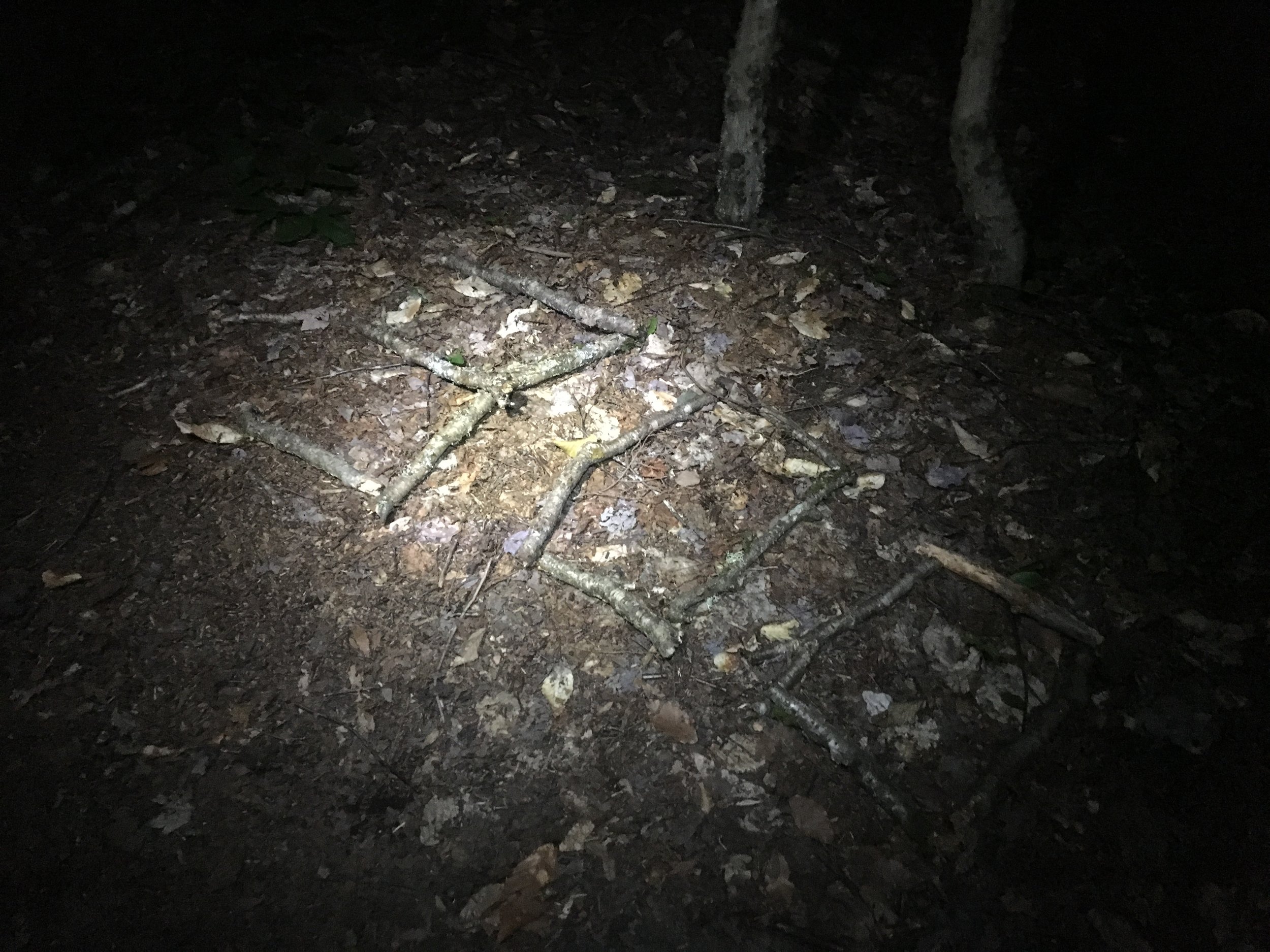
We left the other hikers to get to the trailhead where, undoubtedly, my parents were already waiting. On our way out of the woods, we passed some stick numbers: 300. For southbounders this meant they'd hiked 300 miles. For us northbounders it meant we had 300 miles left to Katahdin. Today was the first day that really sunk in.
IMG_9907
My parents picked us up at the trailhead at 9pm and we went home. That night I thought about the end. I thought about all the things Miles and I hadn't talked about. I considered what it would be like for us to have to split up if we decided not to live together at the end. I thought about going back to work and the struggle of maintaining all of these things I'd learned on the trail.