
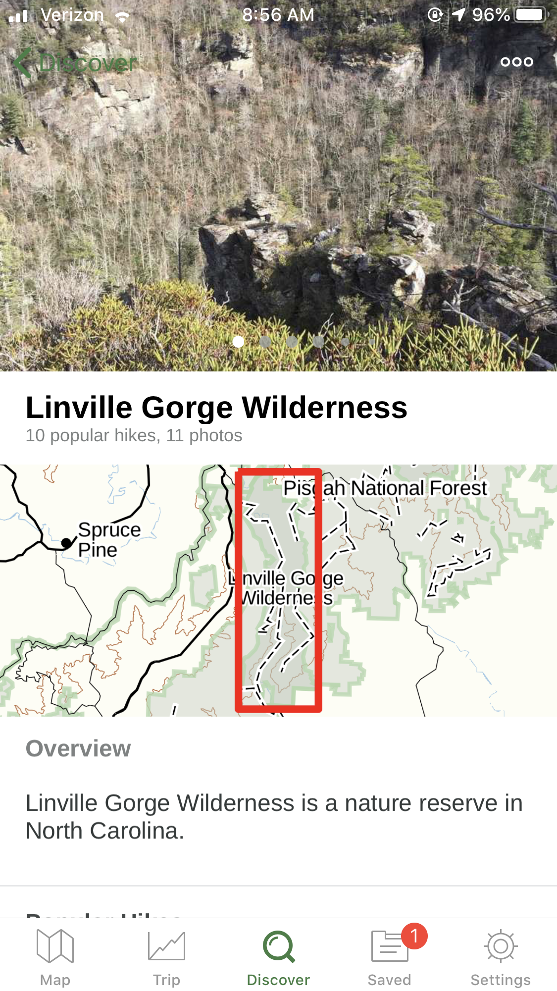
2 Days in the Linville Gorge Wilderness
Paul and I spent one night and one and a half days backpacking in the Linville Gorge Wilderness this past weekend to celebrate his birthday. It was AMAZING! Linville Gorge is beautiful, challenging, and rugged. Here you’ll find the logistics of our hike (duration, route, maps we used, apps we used, etc.) and a trail journal from the weekend!
Logistics
Duration: 2 days + 1 night
Route:
Start/Finish: Spence Ridge Trail Parking
-> Little Table Rock Trail
-> Shortoff Mountain Trail / Mountains To Sea Trail
-> Cambrick / Chambrick Trail (it’s spelled differently on every map)
-> Linville Gorge Wilderness Trail
-> Spence Ridge Trail
Maps:
We used a few different maps to ensure we wouldn’t get lost.
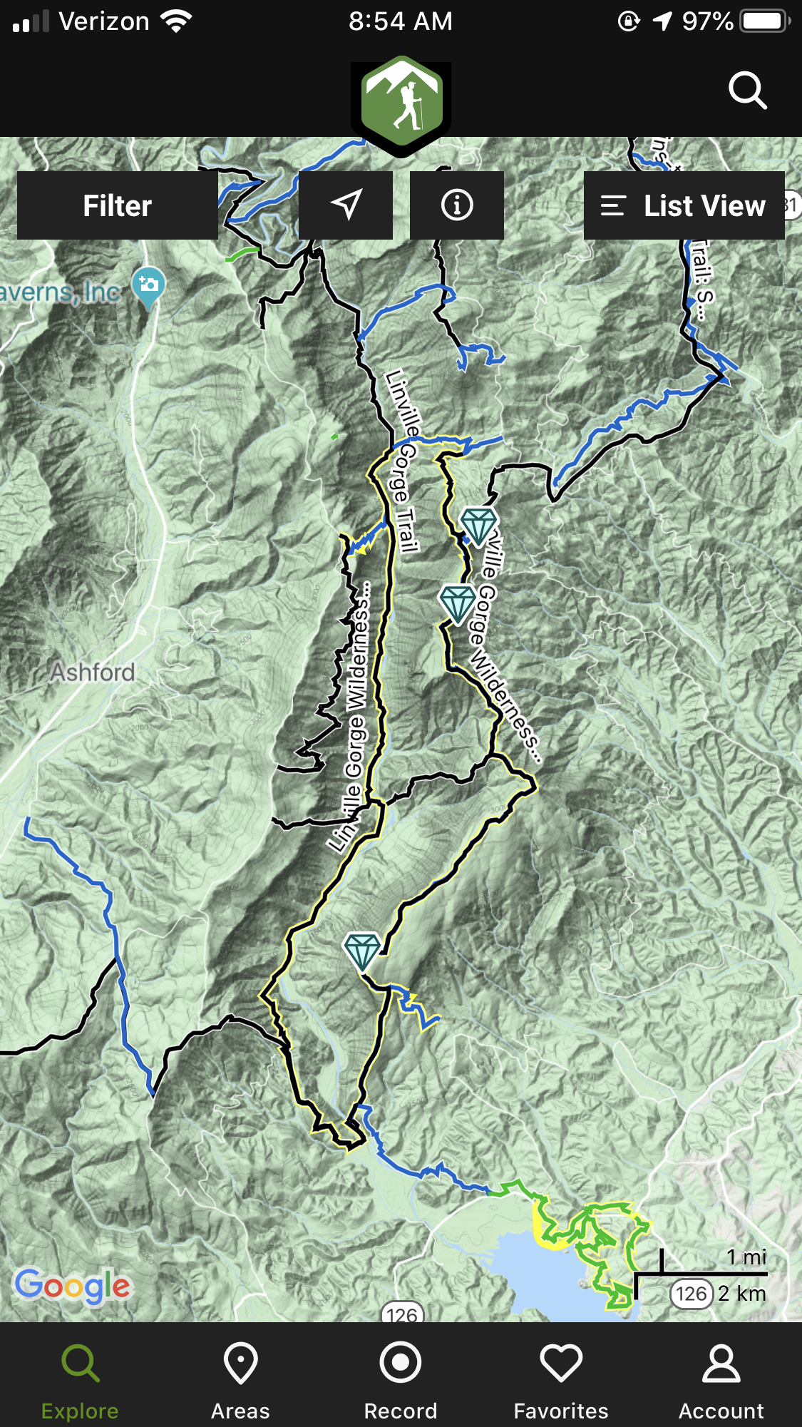
Primarily, we used The Hiking Project (FREE)
GPS: THP’s iPhone app has a mostly accurate GPS feature which allowed us to find our way on the Cambrick Trail which was unmarked and involved some bushwacking. There were also a LOT of side trails that lead nowhere or to campsites. This app let us easily determine what was a side trail and what was the trail we were supposed to be on when there were no blazes.
Offline: THP can be used offline
Water + Camping: shows where water and some campsites are (There are TONS of campsites in Linville Gorge so you don’t ever really need to worry about that!)
Trails: We could view the entire Linville Gorge Wilderness Area and the trails within it on this app all at once on one map.
Distances: THP does not show distances and does not have a scale key to determine distances yourself. This was a major downside to the App
Elevation: This is overlaid on a topographical map but does not have a separate elevation profile for the trails.
Parking: THP does provide directions to parking but did not show all of the parking that Avenza did so we thought we had limited options with this one.
All Trails, we used this mostly for estimating distance. (FREE if you have cell service, PAID for offline maps)
GPS: All Trails has real-time GPS but it’s not always accurate.
Offline: All Trails can be used offline but you have to pay for that feature. It can track your journey on the paid version.
Water + Camping: All Trails does not show where water or campsites are.
Trails: This app only allows you to see one trail at a time, not the whole Wilderness which makes doing a loop with this app kind of challenging.
Distances: All Trails does show how long each trail is so we used it to estimate how many miles we would end up doing. Because we were cutting some trails off by taking other trails (like the Cambrick Trail) it was sometimes hard to estimate.
Elevation: This app has a separate elevation profile feature. We didn’t use it.
Parking: All Trails provides directions to parking. These are sometimes inaccurate so be careful!
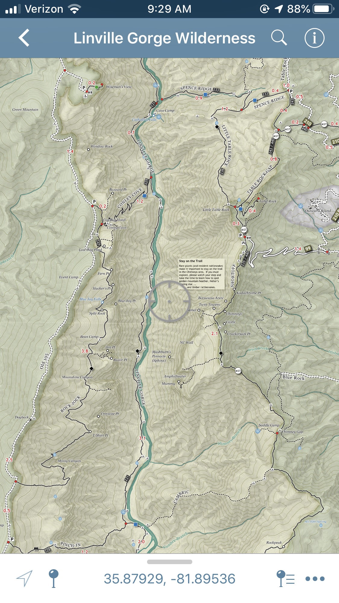
Avenza, we printed this and kept it in a ziplock baggie. (FREE)
GPS: We realized after we got back that Avenza has an app (for iPhone and Android/Google). It has a built-in GPS (unsure of accuracy at the time of this writing).
Offline: This app works entirely offline once the map is downloaded via wifi or cell data.
Water + Camping: Of the maps we used this one marked the most water and campsites and was most reliable in this regard.
Trails: This is a map of the entire Wilderness. Every known trail is on here and can be viewed at the same time on one big map.
Distances: The newly updated 2019 version of this map within the app shows distances of segments of trails (we printed the 2017 version not realizing there was a newer version).
Elevation: This is a topographical map but there are no separate elevation profiles.
Special Features: The app allows you to drop pins. You can mark unmarked campsites, water, views, or whatever you want with custom names and GPS coordinates!
Parking: This map clearly shows how to access trailheads and parking but does not provide directions. It was pretty easy to use route numbers to find the parking lot on Google Maps though and that is how we decided where to park.
Other Suggested maps (which I learned of after our excursion)
In summary, I would absolutely have used the Avenza app over all other apps for this trip and any other trip where Guthook Guides was not available. The ability to drop your own pins, see distances, topographic features, marked water sources (both reliable and unreliable!), ease of use, GPS features, offline capability, and the ability see all of the trails within the Wilderness along with a few extras nearby all make this the best all-around choice.
Trail Log
Day 1

The first day we had incredible weather. Highs in the upper 50’s with a low around 35. We hiked a half a mile from our car, up the Spence Ridge Trail to the Little Table Rock trail. The Spence Ridge portion of the trail was wide and super easy.
The fall air was crisp and so were the leaves that covered the ground. The sun was clear and shining. There wasn’t a single cloud in the sky. I could not stop telling Paul, “I’m so happy we’re out here.” The hiking and the weather and the silence felt so good.
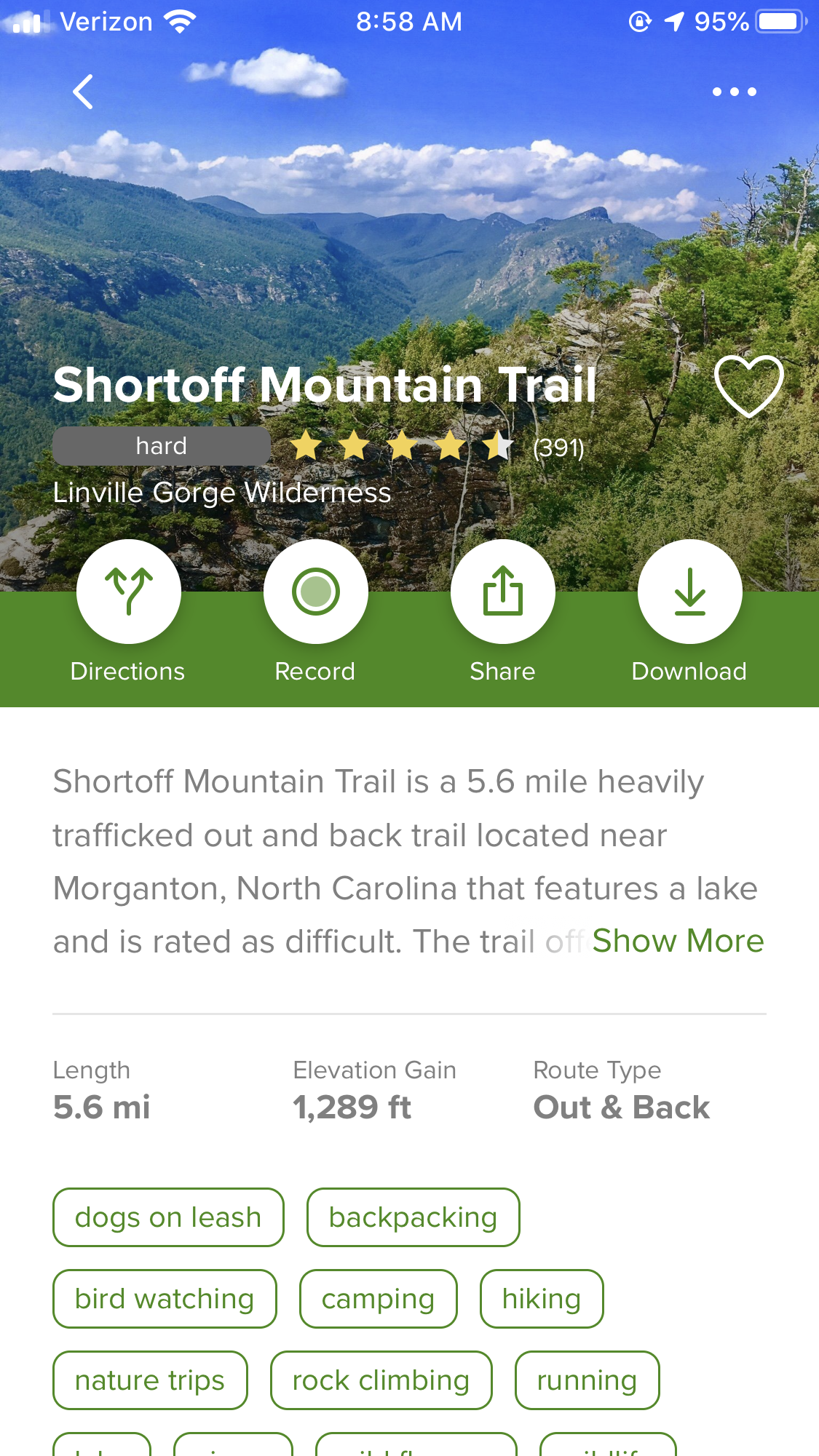
The Little Table Rock Trail was well-trafficked and easy to follow despite it having no blazes. It was a steep climb up to the ridge covered in leaves. We hiked about a mile and a half to the summit of Table Rock.
At Table Rock’s Summit, we met the Mountains to Sea Trail which follows the Shortoff Mountain Trail. This portion of the trail was also easy. There were a few small rock scrambles, but it was well-trafficked, and the trail was blazed and clear. We passed a lot of climbers and incredible looking walls.
For most of the day, we were walking along a ridge with a view. Overlooks were abundant and we couldn’t help but stop and take a look at each one.
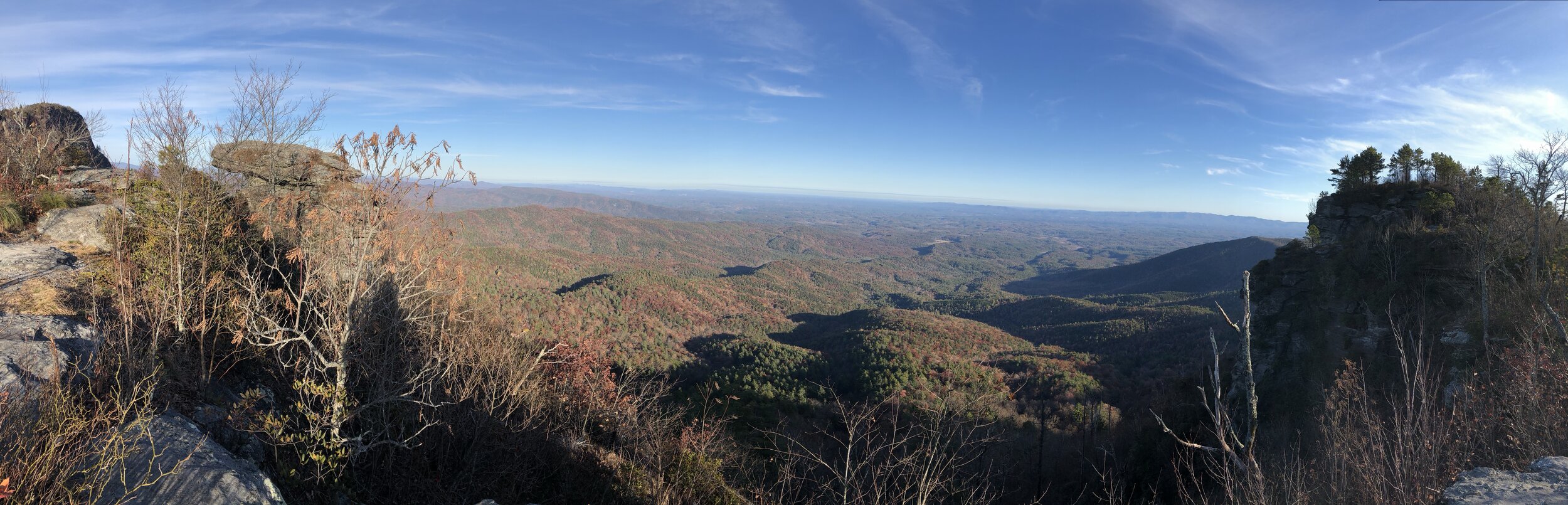
At around 4pm we found a well-hidden side trail that lead to the perfect campsite! Paul set up his hammock and I set up my tent as clouds moved in and the sun faded. The air had cooled off but hovered around 40º.

The birds chirped and slowly disappeared accompanied by white noise from the river that we couldn’t see.
I kept walking in circles around our campsite which was perched on a cliff, taking in the views and the fresh air while Paul finished setting up.

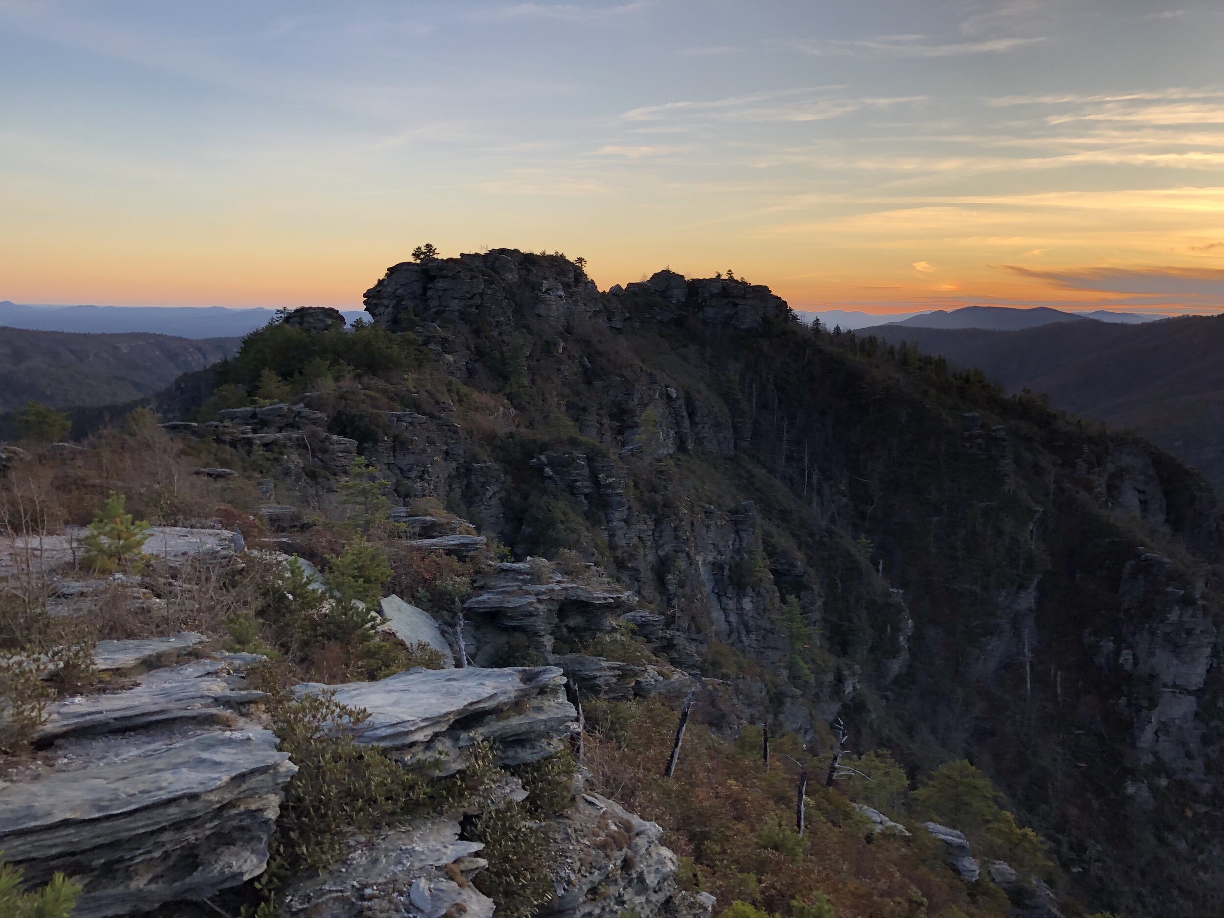
We made dinner together. Then, we carried our meals out to a nearby cliff that we had passed to watch the sunset. The sun shone orange and purple and deep red as it disappeared. The two of chatted while we watched the warning sky change.
Once the sun was down, we headed back up to camp. We crossed the ridge from West to East and saw that below us, to the East, was a large town spread out in the night. It was hard to notice the town in the daytime, tucked into all of the trees.
I saw only a warehouse when we first made camp in daylight. Now, a whole town sparkled down there. The two of us stood on the edge of the cliff, marveling at the tiny, twinkling lights and remarking how small life seemed to be from there.
I pulled my sleeping pad and sleeping bag out into the middle of the little clearing we had made camp in and we laid and watched the stars there. Clouds were gathering all around the high peak we were camped on, but we could still see a big patch of stars.
Four meteors and a lot of guesses about constellations and satellites later, I almost fell asleep outside in the cold night air. It was almost 30º now. But, Paul got up to go read and write in his hammock and I eventually did the same.
I thought about the dreams I’ve had for years about traveling the country in a van and the desire to lead a life of adventure. One big thorn pricked me, though. The same one that always does. Money. I began to get that same anxious vicious cycle of thoughts.
You’ll never make enough money for that.
You have to pay off your debt first.
You have to save up enough to save yourself in an emergency first.
Why can’t you be a better freelancer?
Where’s your motivation gone?
Are you depressed? Of course you’re depressed, don’t fool yourself.
Even in the woods the thoughts before bed were there. It’s true, you can’t run away from your problems. They’ll follow you even into a life of adventure or a relaxing weekend backpacking trip.
I breathed deep and took in the fresh mountain air. The smell of the pine needles I was set up on. The sound of wind and silence.
Somehow even among the racing thoughts and pressure I’d put on myself about my future I was happy. Happy to be in the woods, in my tent. Content in the notion that I was ‘home.’
I tried to tell myself:
It’s all possible. It really is.
You just have to put your head down and do the work to get there.
What work? What is the actual work I need to do to get to where I want to be?
How????
I fumbled over those questions as I fell asleep and dreamed strange dreams. I woke up only once in the night, sweating. Clouds and fog had rolled in and the temperature had risen from about 30º to 45º.
Day 2
We awoke early in the morning to gray, foggy weather. Eager to hike for the day ahead of us.


The maps we were relying on (3 in total) weren’t exactly accurate. They each displayed slightly different distances for all of the trails except Spence Ridge and Shortoff. It looked like it would be about 8-10 miles. We figured that even if we hiked just 1mph (our average is 2.5-3mph) we would complete this by 2pm.
We headed out of camp and followed the Shortoff Trail for a couple of miles down past the Chimneys and into Chimney Gap. As we came into Chimney Gap, it began to drizzle lightly so we pulled out our pack covers and raincoats. We used we went down an unmarked, steep side trail to get water from a small spring. We had to use my cook pot to fill our water bags because the puddle was small and nearly stagnant.
I used my Sawyer MicroSqueeze for the first time, and I loved it!! Review to come.

I chugged a liter of water. We had carried out two liters from the car but had hiked nearly 3 miles yesterday and 3 miles already this morning without drinking water while hiking in order to save it for dinner on the first night.
I didn’t even realize how dehydrated I had become until I drank that water. Oh, how I had missed mountain spring water. Crisp, cool, and fresh. No chlorine. I thought I never want to leave the woods and we were still a full day of hiking away from going home.
We left the spring up the steep side trail and picked up our packs where we’d left them in Chimney Gap.
My hands were freezing but I was so happy to be out, even in the gray weather. The fog wrapped around the large boulders jutting out into the gorge and the gray sky amplified the colors of the fall leaves. I kept breathing in the beautiful smell of mountains, dirt, and rain.


About a half mile later we found the Cambrick Trail.
It’s an unofficial trail. It just looked like a side trail to a campsite. The junction was blocked off with a small stack of twigs to indicate to Mountains to Sea Trail hikers that it wasn’t part of the MST.
We checked The Hiking Project app to make sure it was the trail we were looking for. The GPS arrow pointed in the direction we were headed and we embarked on a journey that lead us down over 1000 feet of elevation loss over the course of 1.5 miles.
The beginning of the Cambrick trail was easy. It was mildly trafficked (enough that you could discern what was trail and what wasn’t) and we passed multiple campsites. It followed the ridge for the first half mile.
After that, it was all downhill and steeply. After weeks of lazing around and barely exercising, I was not prepared for that descent!
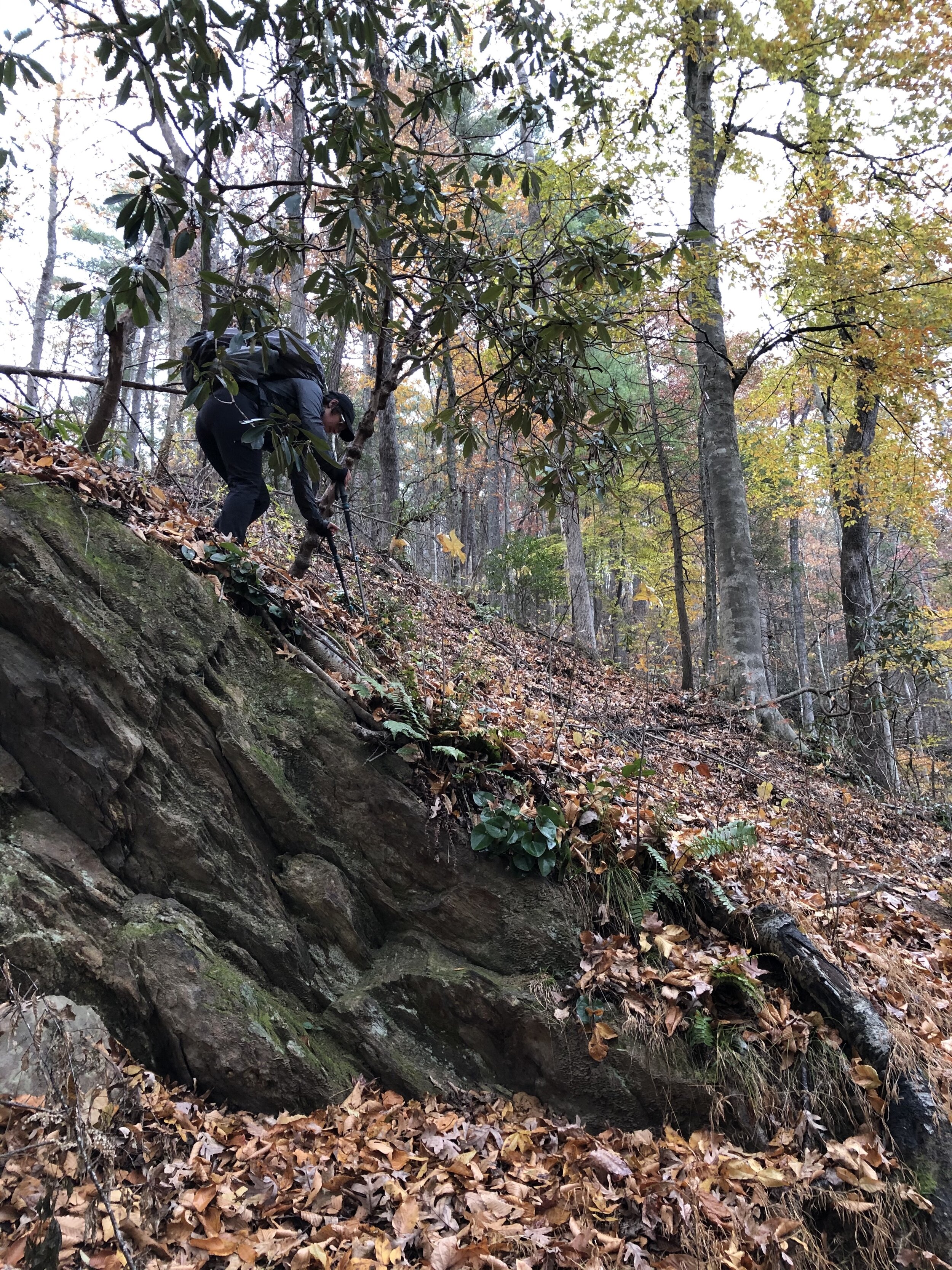
We quickly travelled down and could barely tell where the trail was. In most cases, we determined what was the trail by following the only swath of forest wide enough to walk on as the mountain dropped off on either side of the small ridge we were walking.
Thankfully, Paul lead us through this portion. If I were alone, I surely would have been panicking the whole time and second-guessing whether or not I was actually on the trail.
I braced myself on my trekking poles all the way down and struggled after the first mile to keep using my quads to hold myself up stably. The wet leaves and unending rain made it all the more tricky. Paul and I kept glancing at each other and saying, “It just keeps going! Wow!”
The Cambrick Trail lead us into the bottom of the gorge to a river where the trail promptly ended near a campsite. We knew ahead of time that we would need to forge the river.


The river was cold, strong, and much wider than I had anticipated. The trail we were crossing the river to get to was unmarked but a large, bare patch of land across the river seemed like the most obvious place it could be.
We stood and stared and strategized about how to cross, hoping maybe we could rock hop. With no such luck, I sat down on the ground and began the process of taking off my sneakers and putting on my sandals.
I’m extremely glad I had brought my Chaco’s for this trip, despite their weight. My alternative, EVA Birkenstocks, would definitely have made this crossing even harder albeit my pack much lighter. Some of you have suggested I invest in Xero sandals instead. Honestly, this day made me love my Chaco’s and trust them ten times more and I would even consider thru-hiking with them in the future if there was going to be a lot of water or fording.
I tried my best to stay above water at first, but there came a point where I had to bite the bullet. The water was absolutely freezing. The air outside was about 40º, not bad but not great either. At least the rain had stopped for this part.
I transitioned to rock hopping with big rocks slightly covered by water. I slipped on one about halfway across the river and said, “Fuck it! I’m going!!” I forged through the current, knee-deep, as fast as I possibly could. My feet were freezing and my toes hurt. I couldn’t handle it any longer. I made it to the other side and pulled myself up on a big, dry rock which I followed all the way up to the land on the other side.

I took my pack off in a scramble and realized my pants were soaked up to the mid-thigh region. I had only rolled them up to my knees, not realizing how deep the river actually was. I pulled out my PakTowl and dried to my legs and feet, squeezing my toes with my semi-warm hands.
I pulled out my puffy coat, long johns I’d packed just in case, and my insulated Ragged Mountain Equipment skirt that I used at night to keep my butt warm. I pulled off my pants and put the dry long johns on, then bundled up as quickly as possible.
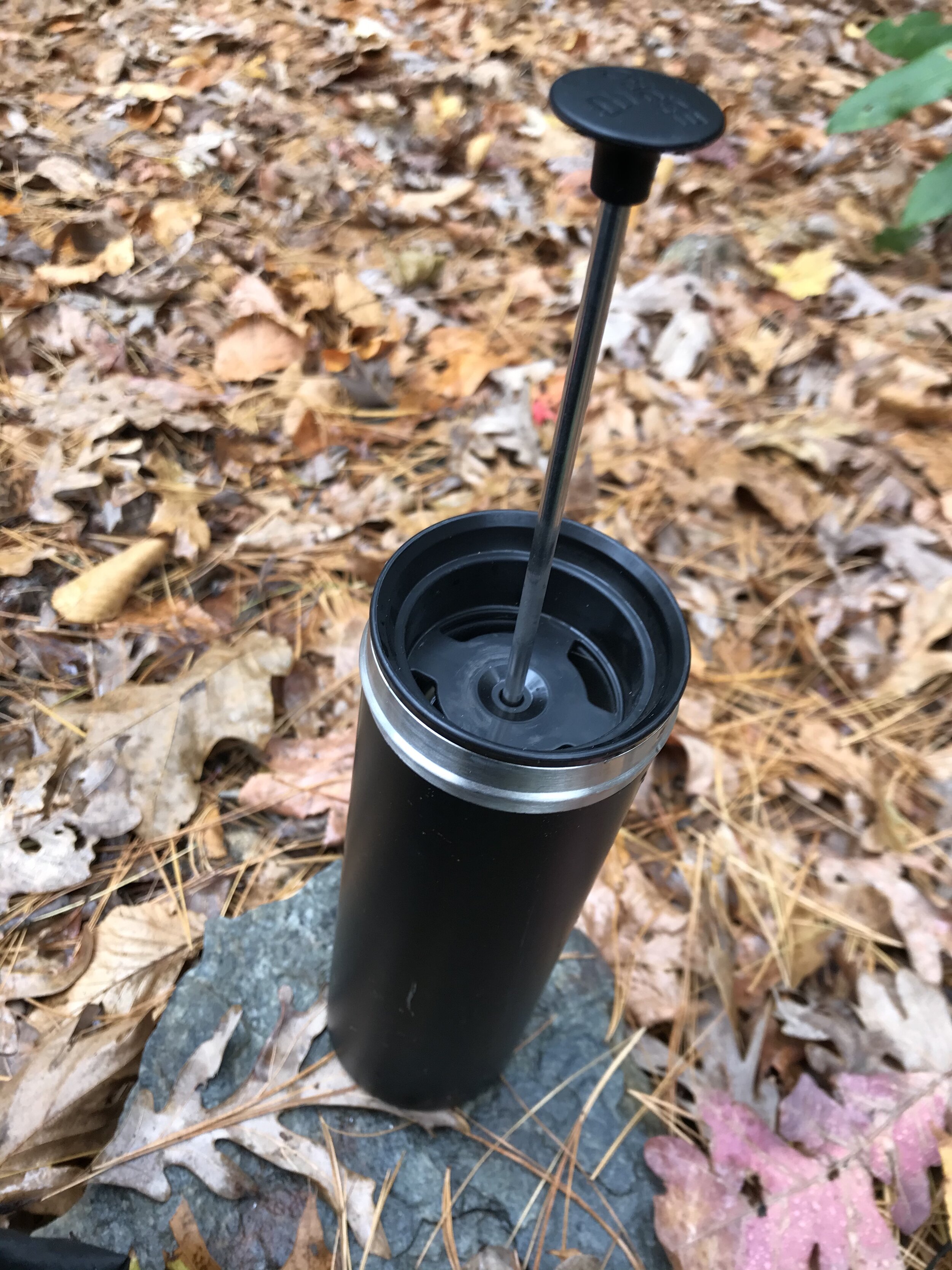
We pulled out some snacks to refuel. I made some coffee with the Espro French press that I had gotten while I was still a Starbucks employee with coffee from the roaster for which I now work, Joe Van Gogh.
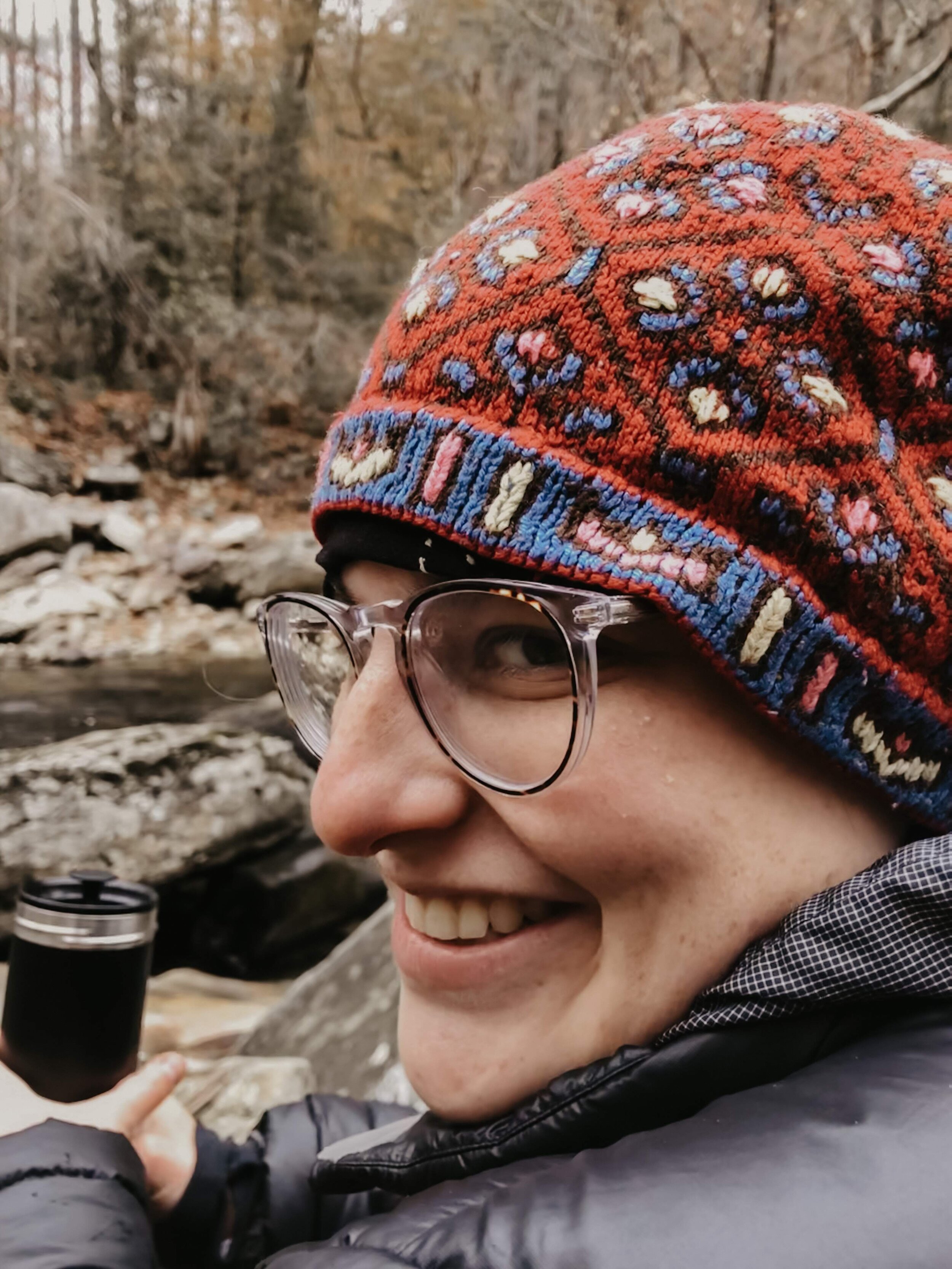
After the coffee steeped and my toes were warmer, Paul and I packed up our things and headed up the trail. He hadn’t had enough of the river yet, though and wanted to stop to drink our coffee nearby the gushing waterfall that was just upstream from where we crossed.
We took a side trail down, clinging to rhododendron branches on the way, and sat on a boulder by the river. We drank coffee, ate Oreos, and contemplated life. I took in the gray, beautiful scene and listened to the water as it ran over the rocks in the most powerfully terrifying way.

We marveled at the way the gray sky turned the water nearly black. We observed how, even without touching it, our brains somehow knew that this water was very cold. Was it the lack of leaves on the trees that gave our brains a clue? Or the deep, dark color of the water? Or maybe it was because the air around us was cold.
After some philosophical banter, we hit the trail again. This time, feeling confident that we were only a few miles from the car and that the trail wouldn’t be too hard after all we’d accomplished that morning (which was only about four miles…).
The Linville Gorge Wilderness Trail, which we embarked on after crossing the river, lead us along the river. It essentially just followed the river as closely as it could, disregarding the huge boulders and cliffs that it brought us up and over.
After about 3 more miles, we came to our final trail: The Spence Ridge Trail. To get to it, though, we had to ford the river again. This time, further upstream where there used to be a bridge of sorts. The bridge was really just two wood beams, about 10 inches wide that were laid across three big boulders. Let’s just say, the Spence Ridge Trail’s original bridge wasn’t for the faint of heart.

We took off our packs and put on our sandals. I put my wet pants back on (brrrr!!) so that I wouldn’t get my dry pants wet. I switched out my ball cap for my warm, knit hat and put my Buff around my neck to stay as warm as possible without risking any important dry clothing.
The current was strong, the water was even deeper than at the last point of crossing, and I was nervous. To start we either had to slide down a huge boulder vertically to a small rock that just barely came up out of the water and then hop to another small rock and ford through the water from there. Or we had to cross on a log just under the surface of the water and hoist ourselves up onto a big, flat boulder and hop halfway across from there before full submerging.
Neither way was exactly comfortable…
We chose the log. Paul went first, stepping out onto the stable log, crossing to another log (both of which were underwater and under a big current), and then hoisting himself up onto the boulder.
I went second and he helped me get up onto the boulder. Then, we lowered ourselves down to another big, flat rock and hopped to the middle of the river. From there, I tried to use rocks underwater that were bigger and relatively close to the surface to keep from submerging my legs any further than my knees.
I breathed deeply, trying to reassure my brain that my toes were okay and didn’t actually hurt. I tried not to panic this time, unlike last time.
I slipped off a rock and lost my balance, but I didn’t let my pack get wet. I did, however, submerge my legs up to my crotch and yelled, “Holy fuck that’s cold!!”
After submerging myself, I sloshed my way across with no regard for depth, current, or safety. I was so cold it hurt and I ended in the same way that I forded the last river: wet and scared.
I hoisted myself onto the last rock and made my way up the slope to where the bridge was supposed to begin.
Once on stable ground, I took my towel back out and dried my toes. I pulled my soaked pants off and dried my legs as much as possible. My waxy white toes looked miserable. They were almost completely numb. I put my socks, wet from walking in the rain, back on and hoped my toes would warm up despite the moisture.
Word to the wise, don’t ford rivers in November if you have Raynaud’s!!! Or buy some neoprene socks.
Once bundled back up, Paul and I took a quick break to eat snacks.
It was almost 4pm by that point. We were cutting it close. I didn’t want to be hiking after dark because the trails were unmarked, and we were unfamiliar with the area. With the variety of trails we’d seen thus far, I didn’t trust this wilderness for anything.
We followed the Spence Ridge Trail back up to the elevation where we started. We came back to the first trail junction we’d seen the day before and stopped to take it all in.
The birds telling each other they were going to bed, the wind in the trees, the river in the distance. I breathed in the fresh air and smelled petrichor, dirt, dead leaves, and mountains. We stood together, not ready to go home yet, knowing that we had to return to civilization and our jobs the next day.